Cherry Creek, South Dakota
Unincorporated community in South Dakota, United States
Cherry Creek, South Dakota čhaŋpȟá wakpála | |
|---|---|
Unincorporated community | |
44°36′17″N 101°29′57″W / 44.60472°N 101.49917°W / 44.60472; -101.49917 | |
| Country | United States |
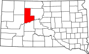
| State | South Dakota |
| County | Ziebach |
| Area | |
| • Total | 0.61 sq mi (1.59 km2) |
| • Land | 0.61 sq mi (1.59 km2) |
| • Water | 0.00 sq mi (0.00 km2) |
| Elevation | 1,726 ft (526 m) |
| Population (2020)[3] | |
| • Total | 282 |
| • Density | 459.28/sq mi (177.41/km2) |
| Time zone | UTC-6 (Central (CST)) |
| • Summer (DST) | UTC-5 (CDT) |
| ZIP codes | 57622 |
| Area code | 605 |
| FIPS code | 46-11540 |
| GNIS feature ID | 2813069[2] |
Cherry Creek (Lakota: čhaŋpȟá wakpála;[4] "Chokecherry Creek") is an unincorporated community and census-designated place (CDP) in Ziebach County, South Dakota, United States.[5] The population was 282 at the 2020 census.[6]
The community takes its name from Cherry Creek.[7]
Demographics
| Census | Pop. | Note | %± |
|---|---|---|---|
| 2020 | 282 | — | |
| U.S. Decennial Census[8] | |||
References
- ^ "ArcGIS REST Services Directory". United States Census Bureau. Retrieved October 15, 2022.
- ^ a b U.S. Geological Survey Geographic Names Information System: Cherry Creek, South Dakota
- ^ "Census Population API". United States Census Bureau. Retrieved October 15, 2022.
- ^ Ullrich, Jan F. (2014). New Lakota Dictionary (2nd ed.). Bloomington, IN: Lakota Language Consortium. ISBN 978-0-9761082-9-0. Archived from the original on October 18, 2016. Retrieved February 12, 2014.
- ^ U.S. Geological Survey Geographic Names Information System: Cherry Creek, South Dakota
- ^ "U.S. Census Bureau: Cherry Creek CDP, South Dakota". www.census.gov. United States Census Bureau. Retrieved June 28, 2022.
- ^ Federal Writers' Project (1940). South Dakota place-names, v.1-3. University of South Dakota. p. 30.
- ^ "Census of Population and Housing". Census.gov. Retrieved June 4, 2016.
- v
- t
- e
Municipalities and communities of Ziebach County, South Dakota, United States
County seat: Dupree
territories
- Dupree
- North Ziebach
- South Ziebach
- Bridger
- Cherry Creek
communities
‡This populated place also has portions in an adjacent county or counties
- South Dakota portal
- United States portal
Authority control databases | |
|---|---|
| International |
|
| National |
|
 | This South Dakota state location article is a stub. You can help Wikipedia by expanding it. |
- v
- t
- e


