Itirapina
Municipality in Southeast, Brazil

Flag

Coat of arms
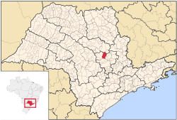
Location in São Paulo state
(2020 [1])
Itirapina is a municipality in the state of São Paulo in Brazil. The population is 18,387 (2020 est.) in an area of 565 km2.[2] The elevation is 770 m.
The municipality contains 56% of the Itirapina Ecological Station, created in 1984.[3]
Media
In telecommunications, the city was served by Companhia Telefônica Brasileira until 1973, when it began to be served by Telecomunicações de São Paulo.[4] In July 1998, this company was acquired by Telefónica, which adopted the Vivo brand in 2012.[5]
The company is currently an operator of cell phones, fixed lines, internet (fiber optics/4G) and television (satellite and cable).[5]
References
- ^ IBGE 2020
- ^ Instituto Brasileiro de Geografia e Estatística
- ^ ESEC de Itirapina (in Portuguese), ISA: Instituto Socioambiental, retrieved 2017-02-19[permanent dead link]
- ^ "Creation of Telesp - April 12, 1973". www.imprensaoficial.com.br (in Portuguese). Retrieved 2024-05-27.
- ^ a b "Our History - Telefônica RI". Telefônica. Retrieved 2024-05-27.
- v
- t
- e
State of São Paulo, Brazil
| Government | |
|---|---|
| Transport | |
| Education |
| Sports |
|
|---|
| |||||||||
- Espírito Santo
- Minas Gerais
- São Paulo
- Rio de Janeiro
| Authority control databases |
|
|---|
 | This geographical article relating to the state of São Paulo is a stub. You can help Wikipedia by expanding it. |
- v
- t
- e


