Oberreute
Municipality in Bavaria, Germany

Coat of arms
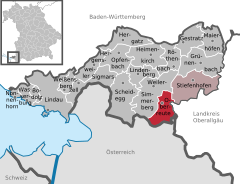
Location of Oberreute within Lindau district
(2020–26) Stefan Schneider[1]
(2022-12-31)[2]
88179
Oberreute is a municipality in the district of Lindau in Bavaria in Germany and member of the municipal association of Stiefenhofen. It is an acknowledged air health resort.
Geography
Oberreute is located in the Allgäu region, on the border with Austria.
History
The contemporary districts of Stadels and Schönebühl once were seat of a court. Oberreute was not formed until the end of the 18th century. In 1797 the first church was built by inhabitants. The town had been part of the Austrian authority of Bregenz-Hohenegg. Since the signing of the peace treaties of Brünn and Preßburg in 1805 the municipality belongs to Bavaria.
Population development
In 1970 1,040, in 1987 1,283 and in 2000 1,471 inhabitants were living in the municipality of Oberreute.
Politics
The mayor of the town is Stefan Schneider.
The revenue from the municipal tax added up to 693,000 € in 1999, of which the net business tax amounted to 101,000 €.
Economy and infrastructure
Economy, agriculture and forestry
According to the official statistics, in 1998 there were neither employees who were subject to social insurance contribution in the industrial sector, nor in the sector of trade and transport at place of work. At place of domicile there were 459 employees altogether. In the industrial sector there were six, in the main construction trade two businesses. Moreover, there were 54 agricultural businesses in 1999 with a total area of 881 ha.
Education
In 1999 there were the following institutions:
- Kindergartens: 50 kindergarten places and 49 children
- An elementary school with four teachers and 82 students
References
- ^ Liste der ersten Bürgermeister/Oberbürgermeister in kreisangehörigen Gemeinden, Bayerisches Landesamt für Statistik, 15 July 2021.
- ^ Genesis Online-Datenbank des Bayerischen Landesamtes für Statistik Tabelle 12411-003r Fortschreibung des Bevölkerungsstandes: Gemeinden, Stichtag (Einwohnerzahlen auf Grundlage des Zensus 2011).
- v
- t
- e
Towns and municipalities in Lindau (district)
- Bodolz
- Gestratz
- Grünenbach
- Heimenkirch
- Hergatz
- Hergensweiler
- Lindau
- Lindenberg im Allgäu
- Maierhöfen
- Nonnenhorn
- Oberreute
- Opfenbach
- Röthenbach
- Scheidegg
- Sigmarszell
- Stiefenhofen
- Wasserburg am Bodensee
- Weiler-Simmerberg
- Weißensberg

Authority control databases | |
|---|---|
| International |
|
| National |
|


