Orhaneli
District and municipality in Bursa, Turkey
39°54′10″N 28°59′15″E / 39.90278°N 28.98750°E / 39.90278; 28.98750 (2022)[1]
16980
Orhaneli is a municipality and district of Bursa Province, Turkey.[2] Its area is 838 km2,[3] and its population is 18,543 (2022).[1]
History
From 1867 until 1922, Orhaneli (then named Adranos) was part of Hüdavendigâr vilayet.
Composition
There are 61 neighbourhoods in Orhaneli District:[4]
- 300 Evler
- Ağaçhisar
- Akalan
- Akçabük
- Altıntaş
- Argın
- Balıoğlu
- Başköy
- Belenoluk
- Çeki
- Celepler
- Çınarcık
- Çivili
- Çöreler
- Dağgüney
- Deliballılar
- Demirci
- Dereköy
- Dündarköy
- Emirköy
- Erenler
- Esentepe
- Eskidanişment
- Fadılköy
- Fevzipaşa
- Firuzköy
- Gazioluk
- Gazipaşa
- Girencik
- Göktepe
- Göynükbelen
- Gümüşpınar
- İkizoluk
- İsmetpaşa
- Kabaklar
- Kadıköy
- Karabekirpaşa
- Karaoğlanlar
- Karasiköy
- Karıncalı
- Koçu
- Küçükorhan
- Kusumlar
- Letafet
- Mahaller
- Nalınlar
- Ortaköy
- Osmaniyeçatak
- Sadağı
- Semerci
- Serçeler
- Sırıl
- Söğüt
- Şükriye
- Süleymanbey
- Tepecik
- Topuk
- Yakuplar
- Yenidanişment
- Yeşiller
- Yürücekler
References
Wikimedia Commons has media related to Orhaneli, Bursa.
- ^ a b "Address-based population registration system (ADNKS) results dated 31 December 2022, Favorite Reports" (XLS). TÜİK. Retrieved 12 July 2023.
- ^ Büyükşehir İlçe Belediyesi, Turkey Civil Administration Departments Inventory. Retrieved 12 July 2023.
- ^ "İl ve İlçe Yüz ölçümleri". General Directorate of Mapping. Retrieved 12 July 2023.
- ^ Mahalle, Turkey Civil Administration Departments Inventory. Retrieved 12 July 2023.
- v
- t
- e
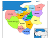
Orhaneli in Bursa Province of Turkey

| Istanbul | |
|---|---|
| West Marmara | |
| Aegean | |
| East Marmara | |
| West Anatolia | |
| Mediterranean | |
| Central Anatolia | |
| West Black Sea | |
| East Black Sea | |
| Northeast Anatolia | |
| Central East Anatolia | |
| Southeast Anatolia | |
Metropolitan municipalities are bolded.
Authority control databases | |
|---|---|
| International |
|
| National |
|
 | This geographical article about a location in Bursa Province, Turkey is a stub. You can help Wikipedia by expanding it. |
- v
- t
- e


