Ramotlabaki
Village in Botswana


class=notpageimage|
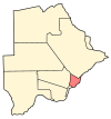
Location of RamotlabakiRamotlabaki is a village in Kgatleng District of Botswana. It is located 120 km north-east of Mochudi, and is close to the border with South Africa. Ramotlabaki has a primary school and the population was 200 in 2001 census.[1]
References
- ^ "Distribution of population by sex by villages and their associated localities: 2001 population and housing census". Archived from the original on 24 November 2007. Retrieved 7 February 2008.
- v
- t
- e
 Kgatleng District of the Republic of Botswana
- Mochudi
- Artisia
- Bokaa
- Dikgonnye
- Dikwididi
- Kgomodiatshaba
- Khurutshe
- Leshibitse
- Mabalane
- Malolwane
- Malotwana Siding
- Matebeleng
- Mmathubudukwane
- Modipane
- Morwa
- Oliphants Drift
- Oodi
- Pilane
- Ramonaka
- Ramotlabaki
- Rasesa
- Sikwane
23°51′9″S 26°55′21″E / 23.85250°S 26.92250°E / -23.85250; 26.92250
 | This Botswana location article is a stub. You can help Wikipedia by expanding it. |
- v
- t
- e


