Talat Phlu
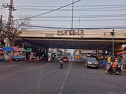
Talat Phlu or Talad Phlu (Thai: ตลาดพลู, pronounced [tā.làːt pʰlūː]) is a community and marketplace by the canal Khlong Bangkok Yai in Talat Phlu subdistrict, Thon Buri district, Thonburi side of Bangkok.
History and present
The history of Talat Phlu dates back to the reign of King Taksin of the Thonburi Kingdom, which followed the fall of Ayutthaya in 1767. At the time, the Thonburi side of the Chao Phraya river was the new capital of Siam (the name of Thailand at that time). Talat Phlu was a community of overseas Chinese or Thai-Chinese, also including Muslims and Mon. After King Rama I took the throne, establishing the Rattanakosin Kingdom, the capital was moved across the river to the Phra Nakhon side. Most of the Chinese moved to live in Sampheng, but some of them remained, descending to the present day.
The name "Talat Phlu" originated in the fact that in the past, this area contained vast phlu (betel) plantations owned by the Thai-Chinese, stretching along Khlong Bang Sai Kai to Khlong Bang Phrom and as far as Khlong Bang Waek. The collected phlu were sold in the area starting from the dyke in front of Wat Ratchakhrue to Wat Intharam, making the area the main wholesale market for mak (Areca catechu) and phlu, hence the name "Talat Phlu" ('betel market'). Today, although the planting of betel has disappeared, the name Talat Phlu remains.[1]
In its heyday (around 1950s–1960s), Talat Phlu was a bustling district, and it was said to be comparable to Yaowarat as one of Bangkok's Chinatowns.[2]
Nowadays, Talat Phlu is famous for its street food, especially gui chai (dumpling stuffed with garlic chives or other filling), a type of dim sum, a Teochew cuisine that came to Siam around the reign of King Rama V.[3] In addition, there are many shophouses and buildings with delicate stucco and wooden fretwork decorations in Chinese style along the road beside the canal worth sightseeing.[2][1]
Area
The name "Talat Phlu" could be taken in a broad sense to encompass the areas of Talat Phlu (subdistrict), Bang Yi Ruea, Bukkhalo, Dao Khanong, it is more often used to refer to the subdistrict only.
Transportation
Talat Phlu can be reached by the State Railway of Thailand (SRT)'s Talat Phlu railway station on Mae Klong Railway Line.
The area is close to Talat Phlu BTS station on the BTS Skytrain's Silom Line, as well as Pho Nimit BTS and Wutthakat BTS stations.
Ratchadaphisek and Thoet Thai Roads are the main street of the area. Soi Phet Kasem 23 (Soi Punyalit Seni) is a shortcut to reach Talat Phlu from Phet Kasem Road in Phasi Charoen area.
References
- ^ a b Saengmanee, Pattarawadee (2018-01-24). "Take your tummy to Talat Phlu". The Nation. Retrieved 2018-03-03.
- ^ a b thepureway (2017-09-27). "Line กนก รากเหง้าหรืออำนาจเงิน ของดีย่านธนบุรี". Mthai (in Thai). Archived from the original on 2018-03-03. Retrieved 2018-03-03.
- ^ Sanfah. "พินิจนคร (Season2) ตอน ตลาดพลู". Thai PBS (in Thai). Retrieved 2024-04-13.
Wikimedia Commons has media related to Talat Phlu.
External links
- Tri-yasakda, Watsamon (2016-06-18). "Soi Food Series: Explore long legacy of street food at Talat Phlu". Coconuts. Retrieved 2018-03-03.
- v
- t
- e
Cultural performances
- Ban Bu Community
- Bangkok Aquarium
- Bangkok Art and Culture Centre
- Bangkok Folk Museum
- Bangkok National Museum
- Bank of Thailand Museum
- Ban Mo Wan
- ChangChui Creative Park
- Coin Museum
- Jim Thompson House
- Khlong Bang Luang Artist House
- King Prajadhipok Museum
- Lhong 1919
- Madame Tussauds Bangkok
- M.R. Kukrit's House
- Museum of Contemporary Art
- Museum Siam
- Pavilion of Regalia, Royal Decorations and Coins
- Queen Saovabha Memorial Institute
- Sala Chalermkrung Royal Theatre
- Sea Life Bangkok Ocean World
- Siam Commercial Bank, Talat Noi Branch
- Silpa Bhirasri National Museum
- Siriraj Medical Museum
- So Heng Tai Mansion
- Thailand Cultural Centre
- National Gallery
- National Museum of Royal Barges
- Asiatique
- Central Embassy
- CentralWorld
- Chatuchak Weekend Market
- Emporium
- EmQuartier
- Gaysorn Village
- Iconsiam
- Khlong Lat Mayom Floating Market
- Khlong Toei Market
- Kwan Riam Floating Market
- MBK Center
- Pak Khlong Talat Market (Flower Market)
- Pantip Plaza
- Patpong Night Market
- Pratunam Market (Clothing Market)
- River City Shopping Complex
- Sampheng
- Samyan Mitrtown
- Saphan Han (Toys and Ladies Market)
- Siam Center
- Siam Discovery
- Siam Paragon
- Siam Square
- Soi Lalai Sap
- Suan Lum Night Bazaar Ratchadaphisek
- Talat Nang Loeng
- Talat Phlu
- Talat Rotfai
- Taling Chan Floating Market
- Terminal 21
- Tha Din Daeng
- Thonburi Market (Sanam Luang II)
- Trok Mo Market
- Wang Lang Market
- Yodpiman River Walk
and transport facilities
- Bangkok railway station (Hua Lamphong)
- Bhumibol Bridge (Mega Bridge)
- BTS Skytrain
- Captain Bush Lane
- Chaloem La 56 Bridge (Elephant's Heads Bridge)
- Charoen Krung Road
- Dinso Road
- Don Mueang Airport
- Khaosan Road
- Krungthep Bridge
- Krung Thep Aphiwat Central Terminal
- Krung Thon Bridge (Sang Hi Bridge)
- Makkhawan Rangsan Bridge
- Memorial Bridge (Phut Bridge)
- MRT
- Odeon Circle
- Patpong
- Rama VIII Bridge
- Ram Buttri Road
- Ratchadamnoen Avenue
- Royal Plaza
- Utthayan Road (Axis Road)
neighbourhoods
- Ban Khrua
- Ban Lao
- Bang Lamphu
- Yaowarat (Chinatown)
- Dusit
- Hua Takhe
- Kudi Chin
- Nana (Little Arabia)
- Phahurat (Little India)
- Pratunam
- Rattanakosin Island (Old Town Zone)
- Royal City Avenue (RCA)
- Sam Phraeng
- Silom
- Soi Cowboy
- Talat Noi
- Tha Chang
- Tha Phra Chan (Amulet Market)
- Tha Tian
- Thonburi
- Thong Lo
- Wang Burapha
Memorials
architectural buildings
- Baiyoke Tower II
- Bangkok City Library
- Customs House
- Drum Tower and Clock Tower
- Fortifications of Bangkok
- General Post Office
- King Power MahaNakhon
- Ministry of Defence headquarters
13°42′59″N 100°28′26″E / 13.716489°N 100.473861°E / 13.716489; 100.473861


