Tokyo Gaikan Expressway
Semi-beltway in the Greater Tokyo area
 | |
|---|---|
 東京外環自動車道 東京外環自動車道 | |
 | |
| Route information | |
| Length | 33.7 km[2] (20.9 mi) |
| Existed | 1992[1]–present |
| Major junctions | |
| From | Tōmei Junction in Setagaya, Tokyo Tōmei Expressway (planned) Tōmei Expressway (planned)Ōizumi Junction in Nerima, Tokyo (current) |
| To | Kōya Junction in Ichikawa, Chiba Higashi-Kantō Expressway Higashi-Kantō Expressway Shuto Expressway Bayshore Route Shuto Expressway Bayshore Route |
| Location | |
| Country | Japan |
| Major cities | Wakō, Toda, Saitama, Kawaguchi, Sōka, Yashio, Misato |
| Highway system | |
| |
The Tokyo Gaikan Expressway (東京外環自動車道, Tōkyō Gaikan Jidōshadō) is a national expressway in Japan. It is owned and operated by East Nippon Expressway Company.
Overview

The name Gaikan refers to the route's status as an outer ring road (beltway) for Tokyo. The expressway is also referred to simply as Gaikan for short. It is the second of three expressway ring routes in the greater Tokyo area: the innermost is the Central Circular Route, then the Gaikan, and the outermost is the Ken-Ō Expressway.[1] The Inner Circular Route of the Shuto Expressway is apparently not considered a true ring road, as the alternate Japanese name of the Ken-Ō Expressway (English name is Metropolitan Inter-City Expressway) is 三環状道路, with the first character meaning 'three' not 'four.' A section of the expressway on the northern side of the Tokyo area was the first to open to traffic (Ōizumi Junction to Misato-minami Interchange). Most of this section is an elevated roadway built on the median of National Route 298 with curved windbreaks on both sides. Most of the roadway has two lanes in each direction (three lanes from Ōizumi Junction to Wakō-kita Interchange).
The eastern section from Misato to Ichikawa was opened to the public on 2 June 2018, three years after schedule.[3] The western section from Izumi to the Chuo expressway is under construction, while the final section linking to the Tomei expressway is still at the planning stage.[4] The western section will pass through the densely populated suburbs of western Tokyo; large parts of it will consist of tunnels constructed at least 40 m underground (deep underground).[5]
The toll for a regular passenger car is currently 500 yen regardless of the distance travelled. Electronic Toll Collection (ETC) is accepted.[6]
List of interchanges and features
- PA - parking area, TB - toll gate
| Prefecture | Location | km | mi | Exit | Name | Destinations | Notes |
|---|---|---|---|---|---|---|---|
| 16.2 km section under construction, planned connection to Tōmei Expressway | |||||||
| Tokyo | Nerima | 0.0 | 0.0 | 50 | Ōizumi | Tokyo Metropolitan Route 24 (Nerima Tokorozawa Route) Kan-etsu Expressway north Kan-etsu Expressway north | Current western terminus |
| Saitama | Wakō | 3.4 | 2.1 | 51 | Wakō | Saitama Prefecture Route 88 (Wakō Inter Route) | |
| 5.3 | 3.3 | 52 | Wakō-kita |  National Route 298 National Route 298 | No through access between exit and PA | ||
| 5.3 | 3.3 | PA | Niikura | U-turns possible | |||
| Wakō / Toda border | Sakitama Bridge | ||||||
| Toda | 7.6 | 4.7 | 53 | Toda-nishi | National Route 298 | Misato-bound exit, Ōizumi-bound entrance only | |
| 8.5 | 5.3 | 60 | Bijogi |  Ikebukuro Route Ikebukuro Route Ōmiya Route Ōmiya Route | Controlled by traffic lights | ||
| 9.9 | 6.2 | 61 | Toda-higashi | National Route 298 | Ōizumi-bound exit, Misato-bound entrance only | ||
| Kawaguchi | 12.3 | 7.6 | 62 | Gaikan Urawa | National Route 298 | Ōizumi-bound exit, Misato-bound entrance only | |
| 14.0 | 8.7 | 63 | Kawaguchi-nishi | National Route 298 | Misato-bound exit, Ōizumi-bound entrance only | ||
| 16.8 | 10.4 | 64 | Kawaguchi-Chūō | National Route 298 | Ōizumi-bound exit, Misato-bound entrance only | ||
| 17.6 | 10.9 | 70 | Kawaguchi |  Tōhoku Expressway north Tōhoku Expressway north Kawaguchi Route south Kawaguchi Route south | |||
| 19.0 | 11.8 | 71 | Kawaguchi-higashi | National Route 298 | Ōizumi-bound exit, Misato-bound entrance only | ||
| Sōka | 22.4 | 13.9 | 72 | Sōka | National Route 298 National Route 4 National Route 4 | ||
| Yashio | 73 / PA | Yashio | National Route 4 | Planned | |||
| Misato | 28.4 | 17.6 | 74 | Gaikan Misato-nishi | National Route 298 | Misato-bound exit, Ōizumi-bound entrance only | |
| 29.6 | 18.4 | 80 | Misato |  Jōban Expressway Jōban Expressway Misato Route Misato Route | |||
| 31.0 | 19.3 | 81 / TB | Misato-Chūō | National Route 298 | Ōizumi-bound exit, Kōya-bound entrance only | ||
| 33.7 | 20.9 | 82 | Misato-minami | National Route 298 | Kōya-bound exit, Ōizumi-bound entrance only | ||
| Chiba | Matsudo | 39.1 | 24.3 | 83 | Matsudo | National Route 298 | Ōizumi-bound exit, Kōya-bound entrance only |
| Ichikawa | 40.1 | 24.9 | 84 | Kita-Chiba |  National Route 464 (Kita-Chiba Road) National Route 464 (Kita-Chiba Road) | Planned | |
| 41.3 | 25.7 | 85 | Ichikawa-kita | National Route 298 Chiba Prefecture Route 264 (Takatsuka Shinden Ichikawa Route) | Kōya-bound exit, Ōizumi-bound entrance only | ||
| 44.7 | 27.8 | 86 | Ichikawa-Chūō | National Route 298 | Ōizumi-bound exit, Kōya-bound entrance only | ||
| 45.9 | 28.5 | 90 | Keiyō |  Keiyō Road Keiyō Road | |||
| 47.6 | 29.6 | 91 | Ichikawa-minami | National Route 298 | Kōya-bound exit, Ōizumi-bound entrance only | ||
| 49.2 | 30.6 | 100 | Kōya | Higashi-Kantō Expressway Bayshore Route | Eastern terminus | ||
1.000 mi = 1.609 km; 1.000 km = 0.621 mi
| |||||||
Gallery
-
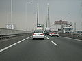
 Gaikan above Route 298
 -
-
 Gaikan passing under Tōhoku Shinkansen
 -
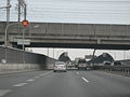
 Traffic lights at Bijogi JCT


References
- ^ a b Ministry of Land, Infrastructure and Transport. "History of Tokyo's 3 Ring Roads". Archived from the original on 2 April 2008. Retrieved 17 April 2008.
- ^ "E-NEXCO Expressway Data". Retrieved 13 April 2008.
- ^ "E-NEXCO Opening Schedule". Retrieved 15 April 2008.
- ^ "E-NEXCO Opening Schedule". Retrieved 30 December 2019.
- ^ Ministry of Land, Infrastructure and Transport. "Tokyo Gaikan Website". Retrieved 15 April 2008.
- ^ "E-NEXCO Drive Plaza Route Search". Retrieved 15 April 2008.
External links
- (in Japanese) East Nippon Expressway Company
- (in Japanese) About the Gaikan (Chiba section)
- (in Japanese) Tokyo Ring Step (Tokyo section)
- v
- t
- e
 East Nippon Expressway Company
- C3 Tokyo Gaikan
- E4 Tōhoku
- E4A Aomori
- E4A Hachinohe
- E5 Dō-Ō
- E5A Sasson
- E5A Shiribeshi
- E6 Jōban
- E7 Nihonkai-Tōhoku
- E7/E46 Akita
- E8 Hokuriku
- E13 Tōhoku-Chūō
- E14 Tateyama
- E17 Kan-etsu
- E18 Jōshin-etsu
- E19 Nagano
- E38/E61 Dōtō
- E46 Kamaishi
- E48 Yamagata
- E49 Ban-etsu
- E50 Kita-Kantō
- E51 Higashi-Kantō
- E65 Shin-Kūkō
- C4/E66 Ken-Ō Expressway
- CA Tokyo Bay Aqua-Line
- E4A Momoishi Road
- E6 Sendai-Hokubu Road
- E6 Sendai-Tōbu Road
- E13 Yuzawa-Yokote Road
- E14 Keiyō Road
- E14 Futtsu Tateyama Road
- E16 Yokohama–Yokosuka Road
- E45 Sanriku Expressway
- E48 Sendai-Nanbu Road
- E50 Higashi-Mito Road
- E62 Fukagawa-Rumoi Expressway
- E63 Hidaka Expressway
- E82 Chiba-Tōgane Road
- E83 Daisan Keihin Road
- E83 Yokohama Shindō


