Tropical Storm Harold was a moderate tropical storm that made landfall in South Texas in August 2023. The eighth named storm[a] of the 2023 Atlantic hurricane season, Harold developed from a tropical wave that entered the Gulf of Mexico on August 20, after passing through the Bahamas and Straits of Florida. The system steadily organized over the following days, over record-warm sea-surface temperatures in the Gulf, as it progressed westward. Although the disturbance had not become organized enough to become a tropical cyclone yet, due to the threat it posed to southern Texas, the United States–based National Hurricane Center (NHC) initiated advisories on the system as Potential Tropical Cyclone Nine on August 21. The disturbance organized into a tropical depression six hours later, before strengthening into a tropical storm the following morning and receiving the name Harold. Harold continued to strengthen as it moved quickly westward, and the cyclone made landfall on Padre Island, Texas, around 15:00 UTC[b] on August 22, as a 60 mph (95 km/h) tropical storm. Harold quickly weakened as it moved inland over southern Texas and dissipated on August 23, though its remnant mid-level circulation and associated moisture affected the central United States for several more days.
Harold led to severe wind gusts and significant rainfall as it struck Texas. Corpus Christi reported 5.25 in (133 mm) of rain from Harold, including a daily record of 4.74 in (120 mm) on August 22; similarly significant rainfall was reported in northern Mexico, peaking at 4 in (100 mm) in Piedras Negras in the state of Coahuila. A modest storm surge of up to 2.2 ft (0.67 m) was reported at San Luis Pass. Wind gusts of up to 67 mph (108 km/h) affected the area, and over 35,000 electricity customers lost power during the storm. One school district in Texas had to shut down for several days following the storm due to the damage Harold inflicted on its classrooms. The remnants of Harold affected the southwestern United States for several days, producing flash flooding that killed one person and left another missing in Nevada. Overall damage from Harold was minor in most areas, however.
Harold developed from a tropical wave that left the west coast of Africa sometime between August 8–10. The wave crossed the tropical Atlantic Ocean over the next week.[1]Convection increased over the northern of the wave on August 17, to the north of the Dominican Republic.[1][2] The disturbance progressed westward, passing through The Bahamas[3] and southern Florida over the following days,[4] entering the Gulf of Mexico the morning of August 20.[5] The developing system became better organized as it crossed the Gulf, but lacked sufficient organization to be deemed a tropical cyclone by late on August 21. Despite this, due to the National Hurricane Center's (NHC) expectation that the system would strengthen into a tropical storm and strike the Texas coast the next day, advisories were initiated on the system as Potential Tropical Cyclone Nine at 15:00 UTC on August 21.[6] About three hours after being designated a potential tropical cyclone, the system acquired a closed, well-defined circulation; it thus met the criteria of a tropical cyclone and became the ninth tropical depression of the 2023 Atlantic hurricane season at 18:00 UTC that day.[1]
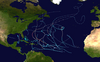
Wind history of Tropical Storm Harold, with orange shaded areas representing areas of tropical-storm force (39 mph (63 km/h) or greater) winds.
The newly formed cyclone continued to become better organized as it moved more quickly westward toward the Texas coast, steered by a mid-level ridge to its north. The depression was upgraded to Tropical Storm Harold at 6:00 UTC on August 22, as the broad cyclone's rain bands began to move onshore.[7] Shortly before landfall, Harold's center reformed to the north of its previous position, and the storm strengthened further to achieve its peak intensity, with maximum sustained winds of 50 mph (80 km/h)[8] and a minimum barometric pressure of 996 millibars.[9] Harold made landfall on Padre Island, Texas by 15:00 UTC at peak intensity.[10] Harold weakened quickly as it moved inland, dropping back to tropical depression status about six hours later, at which time the Weather Prediction Center (WPC) took over responsibility for issuing advisories on the storm from the NHC.[11] Late that day, Tropical Depression Harold crossed into northern Mexico and continued to steadily weaken.[12] The WPC issued its final advisory on Harold at 15:00 UTC on August 23 as its surface low became increasingly ill-defined and dissipated far inland over Mexico.[13] The depression finally degenerated to a remnant low over the Big Bend region of Texas that day.[1] Harold's remnant circulation continued off to the north, crossing back into the United States and passing over portions of the Great Plains. The remnant circulation then turned east and passed through the Midwest before last being noted over Kentucky on August 27.[14]
Preparations and impact
Harold making landfall on the Texas coast on August 22, 2023.
On August 21, upon Harold's precursor's designation as a potential tropical cyclone, a tropical storm warning was issued for much of the coast of southern Texas, from the mouth of the Rio Grande river, at the Texas-Mexico border, up to Port O'Connor, placing 1.3 million residents under the tropical storm warning, with rainfall anticipated to reach up to 7 in (180 mm).[15] A Tropical Storm Watch was issued from north of Port O’Connor to Sargent. The Texas Division of Emergency Management, the state government's emergency management division, was deployed ahead of Harold's expected landfall, and the Texas State Emergency Operations Center was activated to Level II that day, indicating "escalated response conditions".[16] Several school districts in multiple communities across the southern Texas coast were closed in advance of the storm for several days.[17] City services in Corpus Christi were to remain in place during the storm, including public works and transportation.[18] Residents across southern Texas were advised to prepare for the potential for flash flooding and tornadoes, while additional flood watches were issued further northwest into portions of Arizona, New Mexico, and Utah.[19]
Harold struck South Texas with strong winds and heavy rain as it moved across the region. A modest storm surge of 1.6–2.2 feet (0.67 m) was reported in areas including Port Lavaca, Galveston Bay, and San Luis Pass. Sustained winds of 36 mph (58 km/h), with stronger gusts of 59 mph (95 km/h), were reported at Corpus Christi International Airport, as well as 3.06 in (78 mm) of rainfall. A peak wind gust of 67 mph (107 km/h) was measured at Loyola Beach, while rainfall peaked at 6.98 in (177 mm) in Orange Grove.[1] Harold's rains were somewhat beneficial in certain areas of Southern Texas, which was in the midst of a moderate to severe drought before Harold's landfall.[20] Harold dropped a total of 4.74 in (120 mm) of rain in a 24-hour period in Corpus Christi, setting a new daily rainfall record for the city, surpassing the previous record set by the much more powerful Hurricane Bret in 1999. Further, Corpus Christi was originally on track for one of its driest summers on record before Harold's landfall, but following the storm the city's summer rainfall rose above the seasonal average.[21] Total rainfall from Harold reached 5.42 in (138 mm) in Corpus Christi and 5.15 in (131 mm) in Portland. Wind gusts of 65 mph (105 km/h) affected Corpus Christi as well.[22] Two EF0 tornadoes were recorded in the counties of Live Oak and Jim Wells, however they caused minimal damage.[23] Over 35,000 homes and business lost power due to Harold. No fatalities were reported from the storm in Texas.[24]
Rainfall produced by Harold and its remnants across the United States from August 19-27.
The remnants of Tropical Storm Harold also brought rainfall to Colorado, with 0.73 in (19 mm) of rain falling in Denver. The highest rainfall total in the state was 2.49 in (63 mm) in Nathrop.[25] The storm brought the first Atlantic tropical rain in the state in 15 years.[26] Moisture from Harold, combined with the remnants of Eastern Pacific Hurricane Hilary, also led to rainfall across parts of Arizona and Nevada.[27] Thunderstorms over the Las Vegas Valley caused flash flooding that inundated parts of the Las Vegas Strip, flooding two casinos. One person drowned in the intense flooding, while another was reported missing.[28]
Moderate rainfall and gusty winds affected portions of the Mexican states of Tamaulipas, Chihuahua, Nuevo León and Coahuila, although the strongest winds and heaviest flooding remained north of the states.[29] The heaviest rainfall from Harold in Mexico occurred in the city of Piedras Negras in Coahuila, with over 4 in (100 mm) falling within a few hours. Overall damage from Harold was considered minor.[30]
^ abcdefRichard Pasch; Aidan Mahoney; Heather Nepaul (January 30, 2024). Tropical Cyclone Report: Tropical Storm Harold (PDF) (Report). National Hurricane Center. Retrieved February 28, 2024.
^Papin, Philippe (August 17, 2023). Tropical Weather Outlook, 800 PM EDT Thu Aug 17 2023 (Report). Miami, Florida: National Hurricane Center. Retrieved October 1, 2023.
^Bucci, Lisa (August 19, 2023). Tropical Weather Outlook, 800 AM EDT Sat Aug 19 2023 (Report). Miami, Florida: National Hurricane Center. Retrieved October 1, 2023.
^Kelly, Larry; Brown, Daniel (August 19, 2023). Tropical Weather Outlook, 800 PM EDT Sat Aug 19 2023 (Report). Miami, Florida: National Hurricane Center. Retrieved October 1, 2023.
^Papin, Phillipe; Cangialosi, John (August 20, 2023). Tropical Weather Outlook, 800 AM EDT Sun Aug 20 2023 (Report). Miami, Florida: National Hurricane Center. Retrieved October 1, 2023.
^Cangialosi, John (August 21, 2023). Potential Tropical Cyclone Nine Discussion Number 1 (Report). Miami, Florida: National Hurricane Center. Retrieved October 1, 2023.
^Pasch, Richard (August 22, 2023). Tropical Storm Harold Discussion Number 4 (Report). Miami, Florida: National Hurricane Center. Retrieved October 1, 2023.
^Cangialosi, John; Brown, Daniel (August 22, 2023). Tropical Storm Harold Tropical Cyclone Update (Report). Miami, Florida: National Hurricane Center. Retrieved October 1, 2023.
^Cangialosi, John (August 22, 2023). Tropical Storm Harold Intermediate Advisory Number 5A (Report). Miami, Florida: National Hurricane Center. Retrieved October 1, 2023.
^Cangialosi, John (August 22, 2023). Tropical Storm Harold Discussion Number 5 (Report). Miami, Florida: National Hurricane Center. Retrieved October 1, 2023.
^Cangialosi, John (August 22, 2023). Tropical Depression Harold Discussion Number 6 (Report). Miami, Florida: National Hurricane Center. Retrieved October 1, 2023.
^Gallina, Gregg (August 23, 2023). Tropical Depression Harold Advisory Number 7 (Report). College Park, Maryland: Weather Prediction Center. Retrieved October 1, 2023.
^Carbin, Greg (August 23, 2023). Remnants of Harold Advisory Number 9 (Report). College Park, Maryland: Weather Prediction Center. Retrieved October 1, 2023.
^Oladipo, Glorida; Canon, Gabrielle (August 22, 2023). "Thousands lose power as Texas braces for deluge from Tropical Storm Harold". The Guardian. Retrieved October 1, 2023.
^"Governor Abbott Deploys Resources Ahead Of Tropical Depression Nine" (Press release). Austin, Texas: Office of the Texas Governor. August 21, 2023. Retrieved October 1, 2023.
^Williams, Haley (August 22, 2023). "Schools: Tropical Storm Harold forces delays, closures for Coastal Bend schools into Wednesday". Corpus Christi, Texas: KIII. Retrieved October 1, 2023.
^"Corpus Christi Weathers Tropical Storm Harold". Corpus Christi, Texas: City of Corpus Christi. August 23, 2023. Retrieved October 1, 2023.
^Yablonski, Steven; Brinkmann, Heather; Oberholtz, Chris; Sistek, Scott; Andrews, Hillary (August 22, 2023). "Harold weakens to tropical depression after dumping torrential rain on Texas". Corpus Christi, Texas: Fox News. Retrieved October 1, 2023.
^Henson, Bob (August 22, 2023). "Harold hits South Texas, Franklin heads for Hispaniola". New Haven, Connecticut: Yale Climate Connections. Retrieved October 1, 2023.
^Carly Smith (August 23, 2023). "Tropical Storm Harold brings rain to drought stricken Coastal Bend, and the watershed for the Nueces and Frio River". Corpus Christi, Texas: KIII. Retrieved October 1, 2023.
^Yablonski, Steven; Brinkmann, Heather; Oberholtz, Chris; Sistek, Scott; Andrews, Hillary (August 22, 2023). "Harold weakens to tropical depression after dumping torrential rain on Texas". Corpus Christi, Texas: Fox News. Retrieved October 1, 2023.
^Oladipo, Glorida; Canon, Gabrielle (August 22, 2023). "Thousands lose power as Texas braces for deluge from Tropical Storm Harold". The Guardian. Retrieved October 1, 2023.
^Here's how much rain fell in Colorado, 9News, August 26, 2023
^Colorado receives first Atlantic tropical rain in 15 years, 9News, August 25, 2023
^Yactayo, Noé (August 23, 2023). "Tormenta Tropical Harold en vivo hoy, 23/08/2023 – última hora en México y USA" (in Mexican Spanish). El Comercio Group. Retrieved October 1, 2023.
^Rodriguez, Josue (August 23, 2023). "Pega 'Harold' en Piedras Negras, deja vehículos varados, calles inundadas y árboles caídos". Vanguardia MX (in Mexican Spanish). Saltillo, Coahuila. Retrieved October 1, 2023.
This article incorporates public domain material from websites or documents of the National Weather Service.
External links
The National Hurricane Center's advisory archive on Tropical Storm Harold


 Extratropical cyclone, remnant low, tropical disturbance, or monsoon depression